Busca de Publicações
Filtrar por:
| Autoria: DART, R. de O.; COELHO, M. R.; MENDONÇA-SANTOS, M. de L.; PARES, J. G.; BERBARA, R. L. L. The use of Digital Soil Mapping (DSM) to predict soil classes is an important issue to decrease costs and subjectivity of soil maps. The main objective of this study was to use DSM to produce soil map... ... |
| Autoria: CARVALHO JUNIOR, W. de; BHERING, S. B.; PEREIRA, N. R.; CHAGAS, C. da S.; LOPES, C. H. L. The use of legacy data improve the value of these data and promote the input of new data on the database. Also, reduces the primary data collection and analytical procedures. In MS State, the legacy d... ... |
| Autoria: DART, R. de O.; VASQUES, G. M.; COELHO, M. R.; FERNANDES, N. F. Investment on soil survey has become scarce over the past decades. Digital Soil Mapping (DSM) techniques emerged as an economic alternative to produce soil maps. We applied a classification tree algor... ... |
| Autoria: RODRIGUES, H.; CEDDIA, M. B.; VASQUES, G. M.; GRUNWALD, S.; BABAEIAN, E.; VILLELA, A. L. O. The reference area (RA) approach has been frequently used in soil surveying and mapping projects, since it allows for reduced costs. However, a crucial point in using this approach is the choice or de... ... |
| Autoria: TEN CATEN, A.; DALMOLIN, R. S. D.; RUIZ, L. F. C.; MENDONÇA-SANTOS, M. de L. Soil maps have a great deal of ambiguity regarding the exact location of transition zones, which leads pedologists to disagree about the proper delineation of soil classes at those locations. The aim... ... |
| Autoria: VALLADARES, G. S.; HOTT, M. C. This paper applied pedological mapping in an experimental center of APTA-Frutas in Jundiaí São Paulo, Brazil, using morphometric parameters and GIS tools. The aim of this work was to obtain a prelimin... ... |
| Autoria: ANDRADE, S. F. de; MENDONÇA-SANTOS, M. de L.; CARVALHO, C. N. de; DART, R. de O.; PARES, J. G. The development of methods in digital soil mapping has been an activity that's growing substantially in recent decades. The DSM is quickly evolving from the research stage to map production at various... ... |
| Autoria: VALLADARES, G. S.; HOTT, M. C. This work applied a pedological mapping methodology, in an experimental center of ?APTA-Frutas? in Jundiaí, SP, using the geomorphometric parameters and GIS tools to elaborate pedologic maps. The aim... ... |
| Autoria: BASTOS, B.; PINHEIRO, H.; CARVALHO JUNIOR, W. de Aero geophysical data is becoming an important source of environmental covariate in digital mapping. Airborne gamma-ray spectrometry is more common in digital soil mapping, because of the penetration... ... |
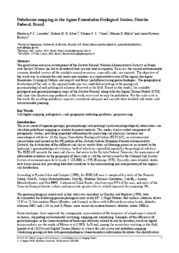
| Autoria: LACERDA, M. P. C.; ALVES, H. M. R.; VIEIRA, T. G. C.; BILICH, M. R.; BARBOSA, I. O. The great urban and rural development of the Distrito Federal (Federal Administrative District) in Brazil over the last 50 years has led to disordered land use and land occupation. To assess the curre... ... |
Observações
1 - Por padrão são exibidas publicações dos últimos 20 anos. Para encontrar publicações mais antigas, configure o filtro ano de publicação, colocando o ano a partir do qual você deseja encontrar publicações. O filtro está na coluna da esquerda na busca acima.
2 - Para ler algumas publicações da Embrapa (apenas as que estão em formato ePub), é necessário ter, no celular ou computador, um desses softwares gratuitos. Sistemas Android: Google Play Livros; IOS: iBooks; Windows e Linux: software Calibre.
Acesse outras publicações
Acesse a Base de Dados da Pesquisa Agropecuária (BDPA) para consultar o acervo completo das bibliotecas da Embrapa.

